Day 22 (May 4, 2017)
Kamitsutsumi, Ōita → Ōita City
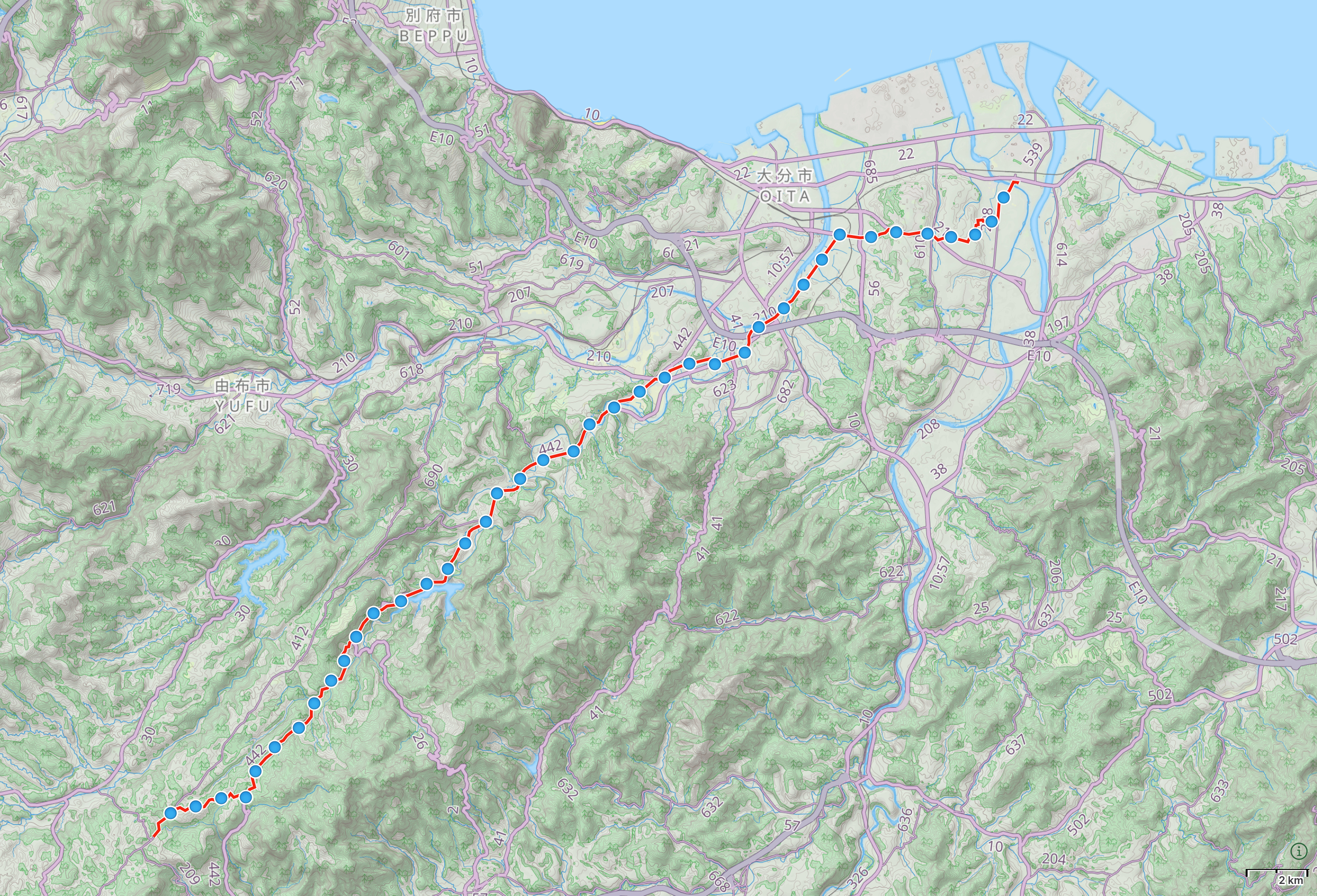
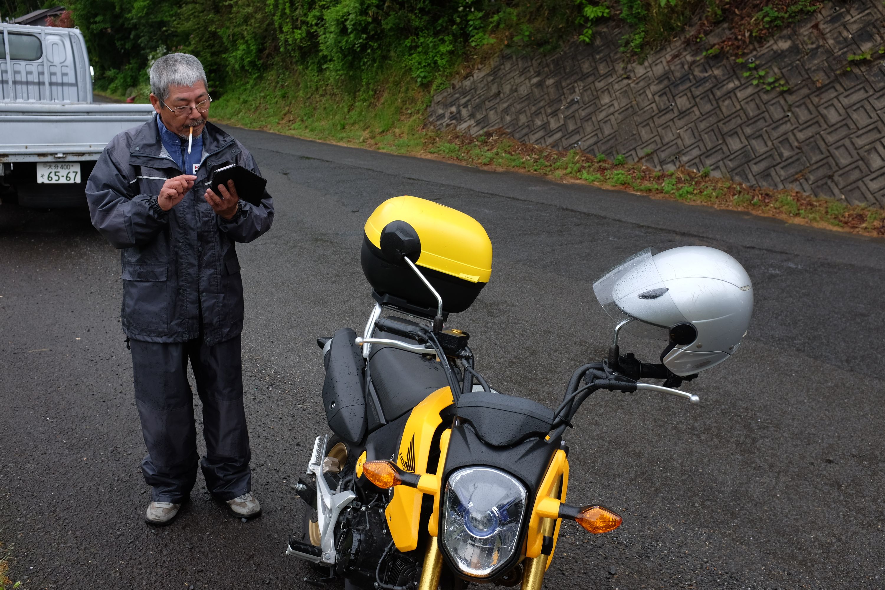
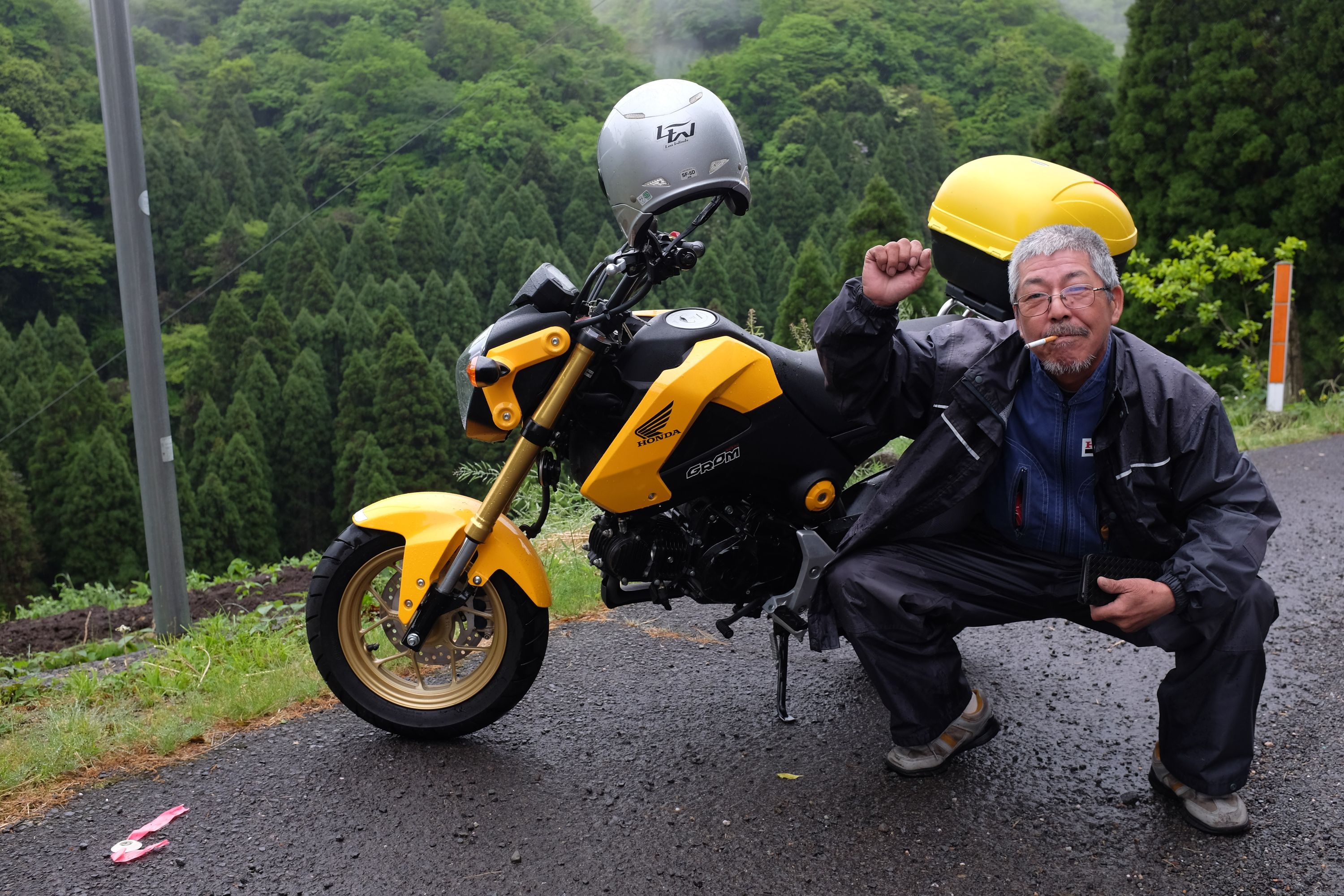
All I heard was a muffled “PETEEEEEEER!!” and the Honda which had screamed past screeched to a stop and turned around. Behind the visor was a huge grin and Mr. Macha, the tempura master, smoking like a maniac, one of the tenkara fishermen from Ōita who had invited me for picnic five days, 130 kilometers, and a mountain range before. “It would be wonderful to go with you but it is an impossibility now,” he said, zipped up his waterproof Honda mechanic’s overalls, and rode back into the rain, into the mountains from where I came, and I laughed for minutes, and I walked to the sea.

Next → Day 23, May 5
Prev. ← Day 21, May 3
These Walking Dreams is a visual field diary of a 4,100-kilometer walk from one end of Japan to the other, in the spring and summer of 2017.